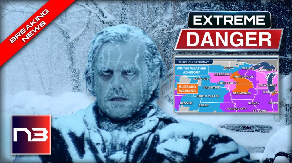
Are you ready for SNOWPOCALYPSE? It looks like Santa Claus is on its way with a massive snow rollout that’s set to make this Christmas truly memorable. Travelers better brace themselves, as this “Paralyzing Bomb Cyclone” is projected to be a life-threatening event, trapping people indoors and grounding flights everywhere.
SNOWPOCALYPSE is coming! A massive snowstorm is about to take over parts of the nation, and with it brings an enormous amount of chaos to what’s supposed to be a joyous Christmas holiday. As heavy rain ushers in life-threatening temperatures that will span from the Plains all the way through to Florida, people across the country are starting to realize that their Christmas celebrations could quickly turn into a nightmare. Temperatures could reach lows not seen in 30 years, certainly making it one of the coldest Christmases ever. So bundle up tight – SNOWPOCALYPSE is on its way.
Fox Weather reports, this week, a dangerous blizzard will turn into a bomb cyclone and wallop the Midwest and Great Lakes, spreading damaging winds southward and creating a travel nightmare for millions.
In addition to dangerous wind chills, accumulating snow is expected across large areas of the country.
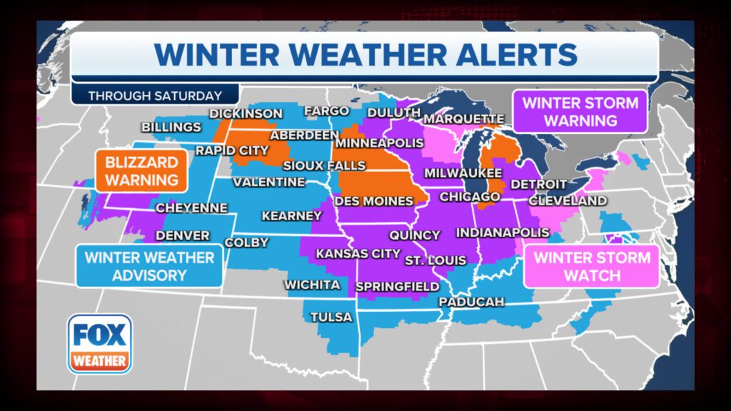

The National Weather Service has issued a number of winter weather alerts from the central and northern Plains eastward to the Midwest, Great Lakes, and parts of the interior Northeast. Buffalo in New York, Chicago, Cleveland, Detroit, Indianapolis, Kansas City in Missouri, Milwaukee, Minneapolis-St Paul, Omaha in Nebraska, and St Louis are among these cities.
In southwestern Minnesota, a Blizzard Warning is in effect, and additional Blizzard Warnings could be issued later Wednesday or Thursday.
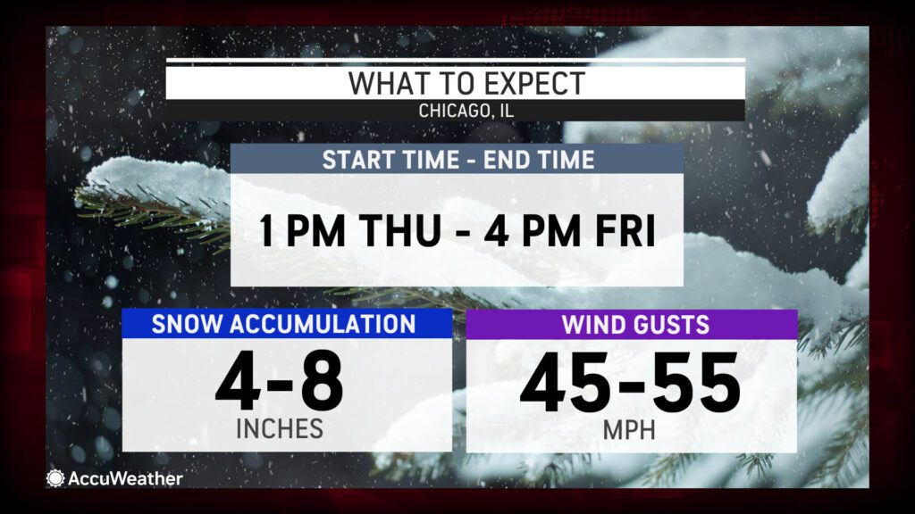
Travelers may be halted in the coming days by a powerful snowstorm, which could transform into an all-out blizzard in Chicago. It is expected to become one of the worst snowstorms in the city’s history, even if snowfall totals fall well short of giant storms in the past.
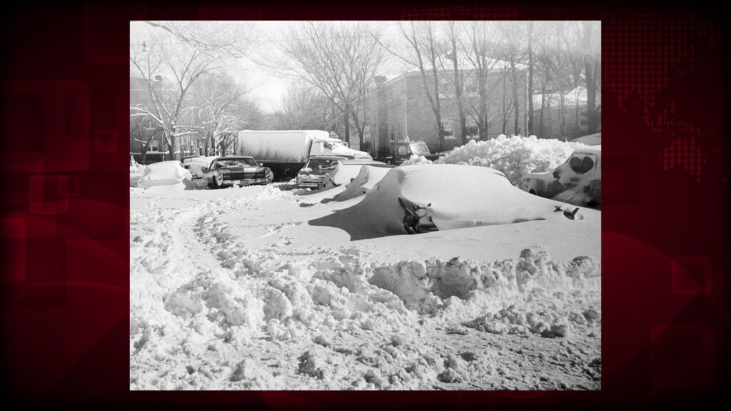
As far as Chicago is concerned, the January 1967 blizzard was the worst snowstorm on record. According to the National Weather Service, 23 inches of snow fell on Jan. 26-27, breaking the 19-inch snow record set on March 25-26, 1930. 20,000 cars and more than 1,000 buses were stranded in the snow, and 60 people tragically died as a result of the storm.

The last blizzard warning issued by the NWS Chicago office was in November 2018.
In Michigan and northern Indiana, where more than a foot of snow is likely, AccuWeather meteorologists predict that while the heaviest snow falls far to the east, this storm could bring Chicago close to the 7.6 inches of snow it typically receives during December.
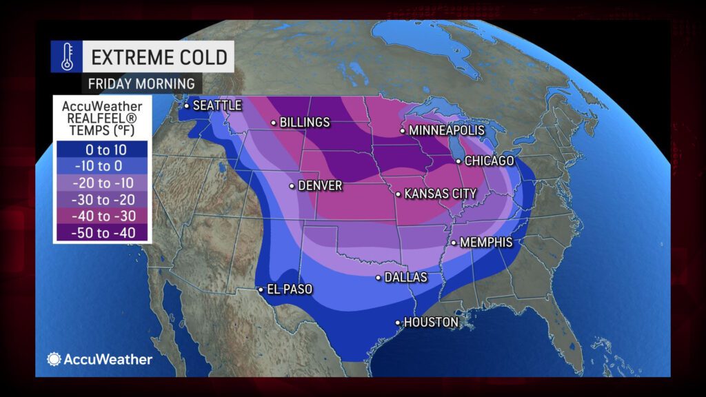

Due to snow, severe cold, and the vast winterscape in the wake of the massive and powerful storm, even a few inches of snow may fall around the Chicago metro area due to a sweep of dry air from the west.

Winter storm conditions will rapidly deteriorate throughout Wednesday as the powerful arctic front sweeps south and eastward across the northern, central, and upper Midwest.
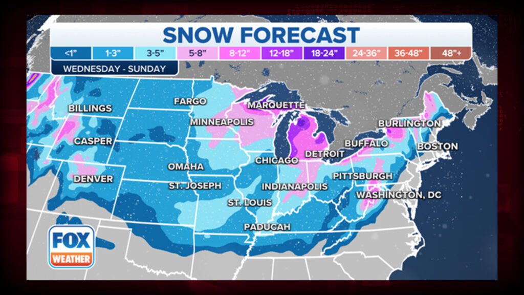

As snowfall rates of one inch or more per hour combine with 40- to 60-mph wind gusts along the front, dangerous snow squalls will produce sudden whiteout conditions.
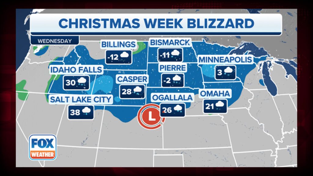

With the passage of the arctic front, the weather will change dramatically. In less than six hours, temperatures will drop by about 40 degrees, causing rain to turn to snow, resulting in a widespread flash freeze as standing water freezes.
Due to the blizzard conditions, high winds, and icy roads, the FOX Forecast Center expects extremely dangerous or impossible travel conditions from the central Plains to the Upper Midwest and western Great Lakes.
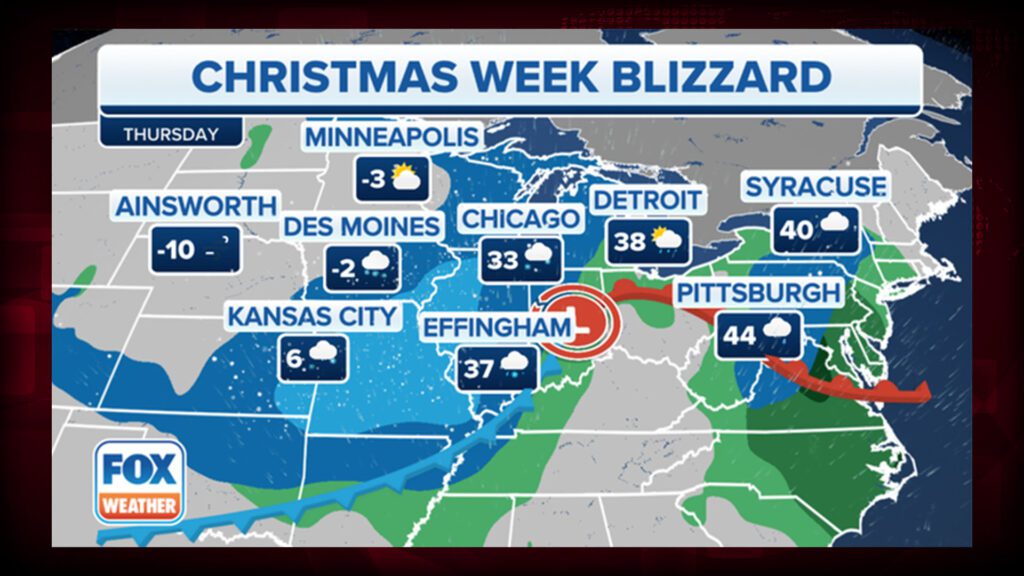

As the winter storm exits eastern Canada on Christmas Eve, high winds will continue to affect the Upper Midwest and Great Lakes region. Through at least Christmas Day, intense lake-effect snow bands are expected to develop in the Great Lakes snowbelts, dumping heavy snowfall in localized areas.
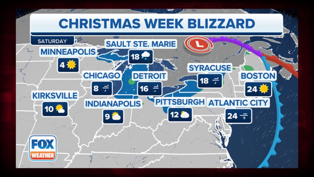

Bomb cyclones are low-pressure systems that explode or intensify very rapidly, causing heavy snow, rain, high winds, and coastal flooding. This week’s Christmas week blizzard will meet these criteria and become a bomb cyclone over the Midwest.
SNOWPOCALYPSE is coming! With a winter storm like no other, the Midwest and East Coast are bracing themselves for heavy snowfall and temperatures that have been predicted to be life-threatening cold. As Christmas chaos looms, areas from Minnesota and northern Iowa in the West all the way to Florida in the East could see record-breaking low temperatures and incredible amounts of snow. Conditions could get especially dangerous with strong winds capable of knocking down tree limbs and power lines -especially if there’s extra added weight from large amounts of snowfall- making this a once-in-a-generation type of event. Keep warm, everyone!
Let’s continue this conversation, in the comments below.
